South Garo Hills is an administrative district in the state of Meghalaya in India. As of 2011 it is the least populous district of Meghalaya (out of 7). The district was established in 1992.
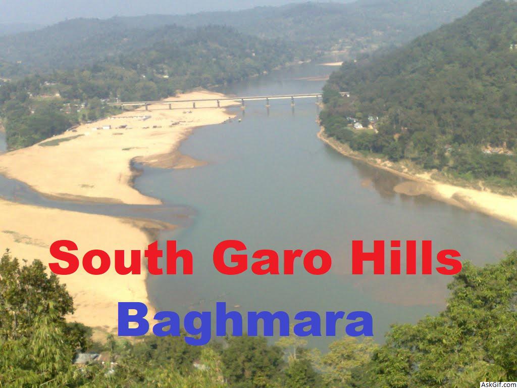
Baghmara is the headquarters of South Garo Hills district in the state of Meghalaya in India. The place is bordered by Bangladesh and is about 113 km from Tura. It has a famous river Someshwari also known as Simsang in Garo tribal language flowing through its expanse and is also covered in hills and tracts along the way.
The famous Siju Cave is about 45 km away and to get to Siju one needs to go through Baghmara. The famous Balphakram National Park is 66 km away and one needs to pass through this town to get there. The modes of transport is limited to buses and jeeps.This place is famous for its tasty fish and has a historical sea trading connection with Bangladesh. It is also a native place of the first Chief Minister of Meghalaya Captain Williamson Sangma and he always represented Baghmara constituency. This place is home to carnivorous plant, the pitcher plant and has the [Pitcher plant sanctuary] located at Dilsa Hill colony of Baghmara.
Geography
The district headquarters are located at Baghmara. The district occupies an area of 1850 km2. South Garo Hills has only 5 assembly constituency at that time but presently it has 3.
Economy
In 2006 the Ministry of Panchayati Raj named South Garo Hills one of the country's 250 most backward districts (out of a total of 640). It is one of the three districts in Meghalaya currently receiving funds from the Backward Regions Grant Fund Programme (BRGF).
Districts
Administrative divisions
South Garo Hills district is divided into four blocks:
Name Headquarters Population Location
BaghmaraBaghmara
South Garo Hills Subdivisions Baghmara.png
ChokpotChokpot
South Garo Hills Subdivisions Chokpot.png
GasuaparaNagrajora
South Garo Hills Subdivisions Gasuapara.png
RongaraRongara
South Garo Hills Subdivisions Rongara.png
Demographics
According to the 2011 census South Garo Hills district has a population of 142,574, roughly equal to the nation of Saint Lucia. This gives it a ranking of 604th in India (out of a total of 640). The district has a population density of 77 inhabitants per square kilometre (200/sq mi) . Its population growth rate over the decade 2001-2011 was 41.19%. South Garo Hills has a sex ratio of 944 females for every 1000 males, and a literacy rate of 72.39%.
Languages
Languages spoken here include A'Tong, a Tibeto-Burman language spoken by 10,000 people in Bangladesh and India.
Flora and fauna
In 1986 South Garo Hills district became home to Balphakram National Park, which has an area of 220 km2 (84.9 sq mi). It shares Nokrek National Park (47 km2 (18.1 sq mi), established in 1986) with two other districts.
It is also home to the Siju and Baghmara Pitcher Plant Wildlife Sanctuaries.
Places of interest
Pitcher Plant Sanctuary at Baghmara
Balphakram National Park
Siju Cave
Pitcher Plant
Simsang River
Chitmang Peak
Pitcher Plant Sanctuary
Bangladesh View
Butterfly Spot
Baghmara-Balpakram forest Reserve
Nengkong cave
History
The name “Baghmara" derived from the fight that took place between Bong Lasker and a wild Bengal tiger where he killed the tiger by crushing the jaws. Hence, the name Baghmara, where, bagh means "tiger" and mara means "died". To remember Bong Lasker, a tomb was built in the heart of Baghmara town. This place was previously known as "Barokar", which means 12 streams. Here " Baro" or "বারো" meaning 12 is also a বাংলা word and "kar" or কার meaning stream in Bangla.
Demographics
As of 2001 India census, Baghmara had a population of 8643. Males constitute 53% of the population and females 47%. Baghmara has an average literacy rate of 70%, higher than the national average of 59.5%; with 55% of the males and 45% of females literate. 16% of the population is under 6 years of age. AS per 2011 Census of India, the population of Baghmara municipality has increased to 13,131 persons.
source: https://en.wikipedia.org/wiki/South_Garo_Hills_district


