Karimganj is one of the 33 districts of Assam, India. Karimganj city is both the administrative headquarters district and the biggest city of this district. It is located in Central Assam and borders Tripura and the Sylhet Division of Bangladesh. It makes up the Barak Valley alongside Hailakandi and Cachar. These three districts were also previously part of the Greater Sylhet region before the Partition of India. It became a district in 1983.
Karimganj is a city in the Karimganj District of the Indian state of Assam. It is the administrative headquarters and main city of the district.
Divisions
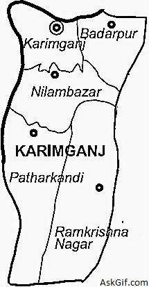
Karimganj District has one sub-division. The district has 5 tehsils or development circles (Karimganj, Badarpur, Nilambazar, Patharkandi and Ramkrishna Nagar), two urban areas (Karimganj and Badarpur) 3 towns (Karimganj, Badarpur, and Badarpur Railway Town), 7 community development blocks (North Karimganj, South Karimganj, Badarpur, Patharkandi, Ramkrishna Nagar, Dullavcherra and Lowairpoa), 7 police stations (Karimganj, Badarpur, Ramkrishna Nagar, Patharkandi, Ratabari, Nilambazaar, and Bazarichara), 96 gram panchayats, and seven anchalik panchayats.
There are five Assam Legislative Assembly constituencies in this district: Ratabari, Patharkandi, Karimganj North, Karimganj South, and Badarpur.[8] Ratabari is designated for scheduled castes.[8] All five are in the Karimganj Lok Sabha constituency.[9]
Administrative Units :
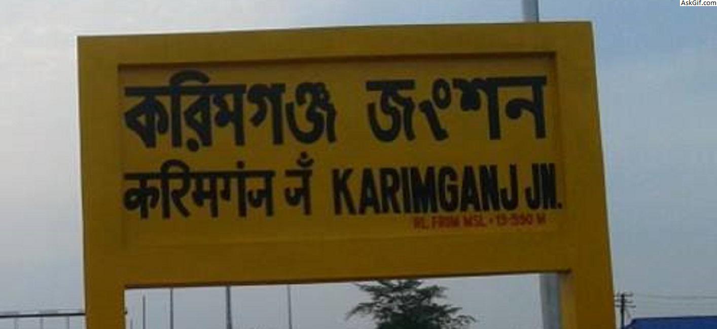
District : Karimganj
District Head Quarter : Karimganj
Police station : Ramkrishna Nagar
Police Outpost : Bhairab Nagar
Block Office : Ramkrishna Nagar
Sub Post Office : Bhairab Nagar (Under Laksmisahar Post Office).
Postal Index Number (PIN) : of788152
Gaon Panchayat : Bhairab Nagar
Assembly Constituency : Ratabari (S.C.Reserved) Assembly Constituency
Parliamentary Constituency : Karimganj (S.C.Reserved) Parliamentary Consyituency
Schools In Bhairab Nagar : Bhairab Nagar has number of L.P. Schools, one Saraswati Vidyaniketan ,Bhairab Nagar M.V. School and one Bhairab Nagar High School which cater to the need of the local people. But they are not sufficiently equipped. So many students go to nearby Hailakandi town for better education.
Politics
Karimganj consists of five assembly constituencies: Karimganj North and Karimganj South, Badarpur, Patharkandi, and Ratabari; all of which are part of Karimganj (Lok Sabha constituency).[3]
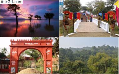
Tourist Attractions
Chhatachura Range: Originating from the south-eastern border of the district of Karimganj, Chhatachura vary forms the district’s border within the eastern side aspect with Hailakandi District. Chhatachura Peak at an altitude of 2087 feet is that the highest point. Saraspur is that the middle section and it’s at one thousand feet high.
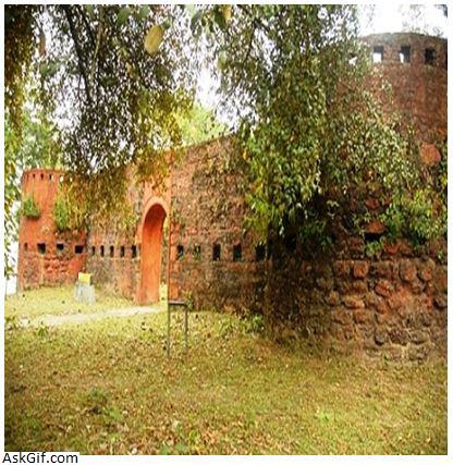
Badarpurghat: Badarpurghat is a historic fort built by the Mughals and later repaired by the British after damaging it during the Sepoy Rebellion of 1857, situated at Badarpur Ghat, the bank of the Rio Singhla, and is only 25 kilometres away from Karimganj town.
Malegarh Crematorium of Sepoy Mutiny Soldiers: - Malegarh Crematorium is considered as a historic place. A sad but brave reminder of past where the soldiers who lost their lives during the 1857 Sepoy Mutiny were cremated. The year 1857 saw the rise of soldiers against British and during the revolt, more than 50 soldiers sacrificed their lives. They were cremated at the place named Malegarh in the district of Karimganj. It was a place of the district Sylhet of Bangladesh earlier before the independence of India.
Son Beel: The place Son Beel is very famous as the 2nd largest wetland in the World as well as largest in Asia, after south american Pantanal and located in Karbi-anglong, Dima haso, hojai and Karimganj in central Assam, as well as Sylhet & Chittagong in Bangladesh. The presence of the hills at the east and west of Son Beel, creates a picturesque landscape. The size of this wetland draws a significant amount of tourists’ attraction. Rio Shingla River' passes through this Beel which Shingla bifurcates into two different rivers -Rio Kakra and Kochua. There is another wetland near Son beel named as Rata beel.
Akbarpur: Indian government established an agriculture research center at Akbarpur to produce the grains of improved quality. The institute provides the training on the agriculture and acts as a helping hand for the farmers.
Suterkandi: Suterkandi is famous for having an international trade centre. Moreover, there is an international border of India and Bangladesh too. India exports the materials like coal, fruits and Silicon to Bangladesh through this space.
source: https://en.wikipedia.org/wiki/Karimganj_district