East Kameng district is one of the 23 districts of Arunachal Pradesh state in northeastern, India. It shares an international border with Tibet in the north and a state border with Assam and district borders with West Kameng, Papumpare and Kurung Kumey, which was bifurcated from Lower Subansiri district on 1 April 2000.
History
The area around the Kameng river has at various times come under the control and influence of the Mon kingdoms, Tibet and the Ahom kingdom. Aka and Nishi chiefs would exert control over the area whenever no major political powers dominated the area.
The Kameng Frontier Division was renamed as the Kameng District. The Political Officer was also redesignated as the Deputy Commissioner of Kameng. However, for political reasons, the Kameng district was bifurcated between East Kameng and West Kameng on 1 June 1980.[2]
Geography
East Kameng district occupies an area of 4,134 square kilometres (1,596 sq mi),[3] comparatively equivalent to Alaska's Unimak Island.[4] Like West Kameng, the East Kameng climate ranges from arid in the tundra of the north through a cool temperate climate to a humid subtropical climate in the southern sub-himalayan hills bordering Assam.
Divisions
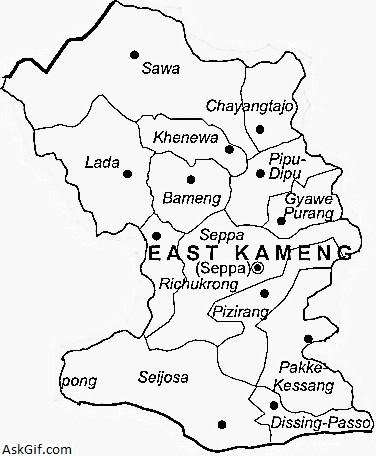
The district is divided into 2 sub-divisions: Seppa and Chayangtajo, which are further divided into 13 administrative circles, namely, Chayangtajo, Sawa, Khenewa, Bameng, Lada, Gyawe Purang, Pipu, Seppa, Richukhrong, Pijirang, Pakke-Kessang, Seijosa and Dissing Passo.
There are 5 Arunachal Pradesh Legislative Assembly constituencies located in this district: Bameng, Chayangtajo, Seppa East, Seppa West and Pakke-Kasang. All of these are part of Arunachal West Lok Sabha constituency.
Population
According to the 2011 census East Kameng district has a population of 78,413,[11] roughly equal to the nation of Dominica.[12] This gives it a ranking of 624th in India (out of a total of 640).[11] The district has a population density of 19 inhabitants per square kilometre (49/sq mi) .[11] Its population growth rate over the decade 2001–2011 was 37.14%.[11] East Kameng has a sex ratio of 1,012 females for every 1,000 males,[11] and a literacy rate of 62.48%.[11]
East Kameng is inhabited by various tribes of similar origin but with distinct cultures and beliefs, practising the Donyi-Polo religion. The most populous of these, the Nishi, are scattered throughout the entire district. Other tribes, especially the Miji, Puroik and the Aka, are found in regions near the Kameng river.
Since independence, much of the population has relocated to the district capital, Seppa. With the coming of modernism, festivals such as the Sarok of the Aka, Nyokum of the Nishi, Jonglam-Ponklam and Chindang of the Miji and the Gumkum-Gumpa are celebrated in full flair in Seppa.
Language
Koro
Main article: Koro language (India)
The Koro is a Tibeto-Burman language spoken by approximately 800–1200 people in the East Kameng district who live among the Aka (Hruso), but their language is distantly related, with distinct words for basic vocabulary.[13][14] Although it has resemblances to Tani further to the east, it appears to be a separate branch of Tibeto-Burman.[15] Koro is unlike any language in the various branches of the Tibeto-Burman family.[16] Researchers hypothesize it may have originated from a group of people enslaved and brought to the area.[17]
Koro was recognised as a separate language in 2010 by a linguistic team of David Harrison, Gregory Anderson, and Ganesh Murmu while documenting two Hruso languages (Aka and Miji) as part of National Geographic's "Enduring Voices" project.[13] It was apparently noticed by earlier researchers.[18]
Tourism
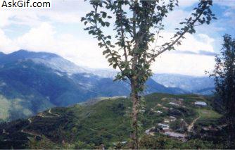
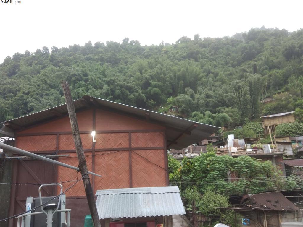
East Kameng has some tourist attractions. One of these is the Pakhui Tiger Reserve, with a wide range of wildlife. Seppa, the capital, hosts tribal dance festivals. The Himalayas can be viewed from the hill stations of Bameng, Chayangtajo and Pakke-Kessang.
Seijosa
Seijosa is a circle in East Kameng district. it has now an Additional Deputy Commissioner office.Mainly Nyishi people inhibit here.The Pakke wildlife Sanctuary is located here. The Seijosa town is situated along the river Pakke. Every Thursday people from Assam mainly from places like Itakola come to sell vegetables, clothes etc. The people from Assam and Seijosa share a cordial relationship. Due to lack of proper road communication and direct link road to Itanagar, often people have to suffer a lot due to frequent Assam Bandh calls and poor communication and network facilities.
Papu Valley
Papu Valley is one of the most spectacular places in East Kameng under the Pijerang circle. Papu Valley has got its name from the snake-like curvy streams of river Papu. A vast field of rice covers the whole area of Papu Valley. Some of the major villages in this valley are Lumdung, Veo, Sede, Seba, Nere etc.
Flora and fauna
In 1977 East Kameng district became home to the Pakhui Wildlife Sanctuary, which has an area of 862 km2 (332.8 sq mi)
source: https://en.wikipedia.org/wiki/East_Kameng_district