Changlang is a census town and headquarters of the Changlang district in the Indian state of Arunachal Pradesh. It has become one of the major districts in the area owing to the presence of crude oil, coal and mineral resources other than tourism and hydro power.
Changlang is located at the co-ordinates 27.12°N 95.71°E.
As of 2001 India census,[3] Changlang had a population of 6,394. Males constitute 56% of the population and females 44%. Changlang has an average literacy rate of 72%, higher than the national average of 59.5%; with male literacy of 78% and female literacy of 65%. 14% of the population is under 6 years of age.
Changlang district is located in the Indian state of Arunachal Pradesh, located south of Lohit district and north of Tirap district. As of 2011 it is the second most populous district of Arunachal Pradesh (out of 16), after Papum Pare.
History
Post-independence
The district was created on 14 November 1987, when it was split from Tirap district.[2]
Geography
Changlang district occupies an area of 4,662 square kilometres (1,800 sq mi),[3] comparatively equivalent to Indonesia's Lombok Island.[4]
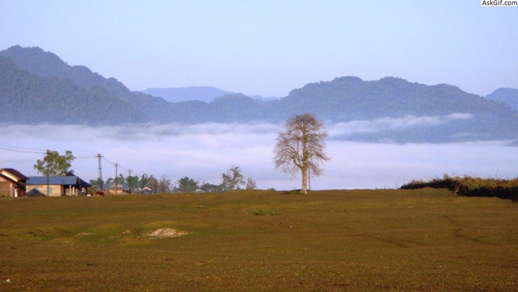
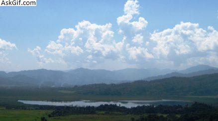
It falls in a region that receives high rainfall. The region is rich in wildlife with different kind of flora and fauna. The district has both plains and highlands. Most of the plains are in the valley of Dihing. The area is prone to occasional floods.
National protected area
Namdapha National Park
Economy
The Dihing is the main source of fishes for the local people.The fresh water fishes are very much in demand they hardly reach major towns nearby like Tinsukia, Doomdooma, Digboi and Dibrugarh.
Administrative divisions
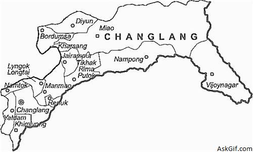
There are 5 Arunachal Pradesh Legislative Assembly constituencies located in this district: Bordumsa, Miao, Nampong, Changlang South and Changlang North. All of these are part of Arunachal East Lok Sabha constituency.[5]
The Changlang district has five Sub-Divisions namely Changlang, Manmao, Jairampur, Bordumsa and Miao.
Changlang Sub-Divisions (Chanlang Block) covers four circles, namely Changlang (14,718 people), Khimiyang (3,506 people), Namtok (3,085 people) and Yatdam.
Manmao Sub-Division (Manmao Block) covers three Circles, namely Manmao (3,814 people), Renuk, and Lyngok-Longtoi.
Jairampur Sub-Division (Nampong Block) covers three Circles, namely Nampong (4,424 people), Jairampur (7,836 people) and Rima-Putak.
Bordumsa Sub-Division ( Bordumsa-Diyun Block) has got only two circles Bordumsa (25,369 people) and Diyun (28,907 people).
And Miao Sub-Division (Khagam-Miao Block) covers three circles namely Miao (20,266 people), Kharsang (9,509 people) and Vijoynagar (3,988 people).
Total, there are fifteen Circles, five Blocks and five Subdivisions in Changlang district.
There are two municipalities Changlang (6,469 people) and Jairampur (5,919 people).
The administrative setup is based on single line administration which aims to keep close co-operation amongst various developmental departments with the district administration and thus, to work together for the speedy development of the area. The district has four Sub-Divisions and a total of 12 circles as shown in Table 2.1 below. The Deputy Commissioner being the overall in-charge of the district administration maintains law and order with the help of administrative officers and police forces. Moreover, the villagers have their own customary administrative systems in the form of traditional village councils consisting of the Gaon Buras and members.
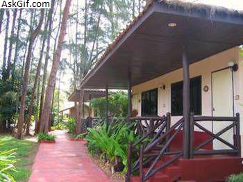
Tourism
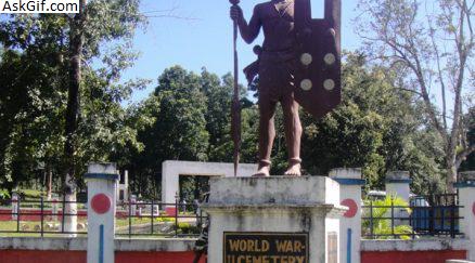
Places to visit are World War II cemetery in Jairampur, Indo-Myanmar border town Nampong and Pangsau Pass. Another place of interest is Bordumsa where the rich culture of the Tais and Singpho exist.
Flora and fauna
The Namdapha Tiger reserve is located in Miao town of this district.
Health services
Although the region is one of the most populous in Arunachal Pradesh, there are hardly any hospitals. It is a great challenge to travel to good hospitals in Assam.
Chakma and Hajong refugees
The Chakma and Hajong refugees in Arunachal Pradesh came from East Pakistan from 1964 to 1969. During that period the refugees 2,902 families (14,888 persons), took refuge in the North-East Frontier Agency (NEFA). The present[when?] population of Chakma and Hajong in Arunachal Pradesh is 54,203 people (9,341 families). In Changlang district it is 47,703 people.[16] The only political developmental step that is taken by the Government of India is an inclusion of 1497 population in the voter list in 2004 by the Election Commission of India.
source: https://en.wikipedia.org/wiki/Changlang_district