Top Places to visit in Khagaria, Bihar
✈️ travel

Top Places to visit in Khagaria, Bihar

4 min read 744 words
4 min read
ShareWhatsAppPost on X
  • 1Khagaria is the administrative headquarters of Khagaria district in Bihar, covering an area of 1,486 square kilometers.
  • 2The district is surrounded by seven rivers, which frequently cause floods and significant loss of life and property.
  • 3Key tourist attractions include the Goddess Durga temple in Sanhouli and the Katyayani temple, attracting numerous pilgrims.

AI-generated summary · May not capture all nuances

Key Insight
AskGif

"Khagaria is the administrative headquarters of Khagaria district in Bihar, covering an area of 1,486 square kilometers."

Top Places to visit in Khagaria, Bihar

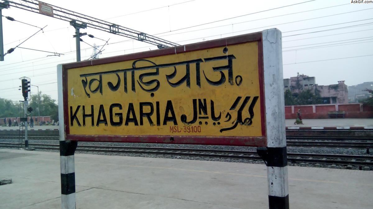
Khagaria is a city in Indian state of Bihar and the administrative headquarters of Khagaria district. Khagaria is a part of Munger division. It is located at 25.5°N 86.48°E and has an average elevation of 36 metres (118 feet). The Khagaria Junction railway station serves the city.

Khagaria district is an administrative district in the state of Bihar in India. The district headquarters are located at Khagaria. Khagaria district is a part of Munger Division.

The district occupies an area of 1486 km² and has a population of 1,276,677 (as of census 2001).

History

Also known as Farakiya in local region. There is an interesting story behind it. Five centuries ago Akbar, then the king of Mughal empire directed his revenue minister Todarmal to map his entire empire. But he could not map this region now known as Khagaria due to difficult terrain, rivers and dense forests. So, he named it Farakiya (Farak in Urdu means separate, different). Now there is even a weekly newspaper- 'Farkiyanchal Times' (albeit published arbitrarily) and Farakiya times (weekly news paper).

Geography

Khagaria district occupies an area of 1,486 square kilometres (574 sq mi),[2] comparatively equivalent to Greenland's Nares Land.[3] The district is surrounded by seven rivers namely Ganges, Kamla Balan, Koshi, Budhi Gandak, Kareh, Kali Koshi and Bagmati. These rivers cause floods every year which causes great loss of life and property including livestock.
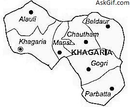
Sub-Divisions

Khagaria district comprises the following Sub-Divisions:

Khagaria

Gogari

Tourist attraction

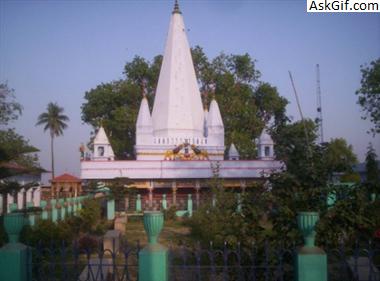
Goddess durga temple at sanhouli

Mother Durga's famous temple is situated in sanhouli , adjacent to Khagaria city for decades. A large number of pilgrims perform religious rituals worshiping here. In addition to various parts of the state, devotees of Assam, Uttar Pradesh etc. States also come here to offer prayers and offerings in mother's court.

source: https://en.wikipedia.org/wiki/Khagaria_district

1. Katyayani Asthan

Katyayani place is situated about 12 kilometers from the district headquarters.There is a temple of Mother Katyayani at this place. Along with this,there is a temple of Lord Rama,Lakshman and Maa Janki too. Every Monday and Friday many devotees come to the temple for worship. It is believed that in this area, the worship of Mother Katyayani occurs in two forms.According to legend,sage Katyayan had known the Kaushik River,which is currently known as Koshi,had austerity on the coast. Pleased with the penance, Mother Durga accepted to be born as the daughter of the sage.Since then, he is also known as Katyayani. In addition, it is said that around 300 years ago this place was surrounded by intensive forests.Once Bhakta Sripat Mahārāj saw the mother Kattayani in a dream and constructed a temple at this place from his direction.

1. Katyayani Asthan
1. Katyayani Asthan

2. Shyamlal National High School

This high school was established in 1910 AD.Shri Shyamlal had donated substantial land for the establishment of the school. Students and teachers of this school have very little in the freedom movement was played an important role. At the time of the independence movement,this place was a prominent place to meet the revolutionaries.

2. Shyamlal National High School

3. Azgaibinath Mahadev

This place is located in Sultanganj of Bhagalpur district. This place is very close to Khagaria district Aguwanighat. The temple of Lord Shiva situated here is on a high mountain.A large number of devotees come to the temple to look for. The temple is characterized by the fact that this temple is on the banks of river Ganga. Because of which devotees go to the temple after taking a bath in river Ganga, to visit Lord Shiva.

3. Azgaibinath Mahadev

4. Accommodation

Hotel Aman, Station Road, Near Railway Station, Khagaria

Hotel Bhawna, Mayaram Market, SDO Road, Near Kalibari Chararia, Khagaria

Hotel Amol, NAC Road, Khagaria

Hotel Aryavrat, Gaoushala Road, Patel Chowk, Khagaria

Hotel Rajasthan, Sagarmal Chowk, Main Road, Khagaria

4. Accommodation
4. Accommodation

5. How to Reach

Khagaria is well connected with the other part of country by roads and trains.

Khagaria is a small town with a major railway junction on the Barauni Guwahati section of the Indian Railways. National Highway No.31, which connects rest of India to North Eastern region passes through this town. It is also connected to other regions of north Bihar by another rail line to Saharsa and Samastipur. Building of a major rail bridge across river Ganges at Munger is underway to connect it to south Bihar and Jharkhand directly.

Roadways : Khagaria can easily be reached from many major cities of India by road. Khagaria can reach National Highway 31.

Railways : Khagaria is connected to many major cities of India by the railways.

Airways : The nearest airport is the Jayaprakash Narayan International Airport in Patna.

source: https://khagaria.nic.in/

5. How to Reach
5. How to Reach

Enjoyed this article?

Share it with someone who'd find it useful.

ShareWhatsAppPost on X

AskGif

Published on 28 January 2019 · 4 min read · 744 words

Part of AskGif Blog · travel

You might also like

Top Places to visit in Khagaria, Bihar | AskGif Blog